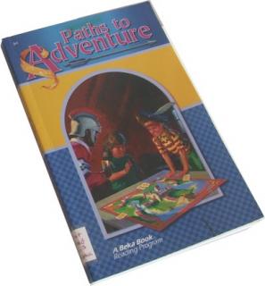
Paths to Adventure
Cincinnatus was a brave Roman who lived many hundreds of years ago. Rome had a powerful enemy that made war against her.
- Obchod: Antikvariát Equilibris
- Dostupnosť tovaru: skladom
- Aktualizované: 3.7.2023
- Cena: 2.20 Eur
Cincinnatus was a brave Roman who lived many hundreds of years ago. Rome had a powerful enemy that made war against her.
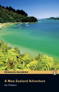
Original / British EnglishSarah and Jessica arrive in New Zealand for a holiday. They find a mobile phone in the taxi from the airport. It is Michael’s mobile, but they can’t find him? He has messages from home – are they important? Go with the girls on a New Zealand adventure.
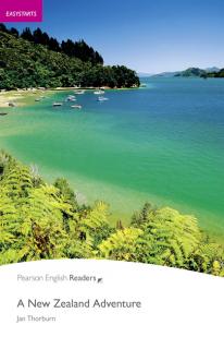
Original / British EnglishSarah and Jessica arrive in New Zealand for a holiday. They find a mobile phone in the taxi from the airport. It is Michael’s mobile, but they can’t find him? He has messages from home – are they important? Go with the girls on a New Zealand adventure.
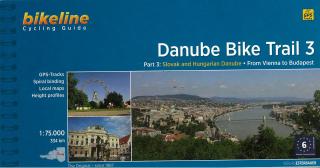
Bikeline Cycling Guide cykloturistický sprievodca DANUBE BIKE TRAIL 3 - Esterbauer PART 3: Slovak and Hungarian Danube - From Vienna to Budapest GPS-Tracks spiral bounding local maps height profiles distance 334 km Charakteristika cyklosprievodcu vydavateľom: Danube Bike Trail 3 The Danube Bike Trail from Passau to Vienna is the most travelled long-distance cycling route in Europe. Every year, thousands of cyclists explore the varied scenery which the route through Austria has to offer. For most cyclist
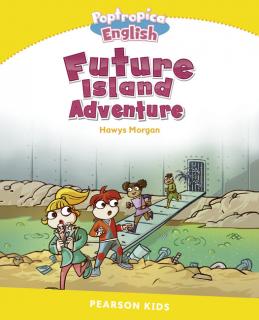
It is one thousand years in the future on the island of Verdana. For Leo, Carla, Tim and Ola, life is sad and boring. There are no trees or animals. The streets are dirty and polluted, and the children are chased by horrible robots! But Ola's grandfather, Popp, remembers life in the past, before Verdana lost its wildlife. "Something terrible happened one day, a long time ago..." Join Popp and the brave young friends on their exciting adventure to clean up the island and stop the robots.
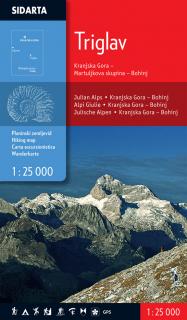
The map covers the central region of of the Julian Alps. Beside the waymarked paths, unmarked trails and ski tours the map includes also: sports climbing areas, natural and cultural points of interest and paragliding take-off sites. GPS, WGS 84.
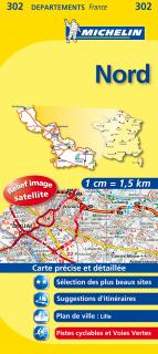
The MICHELIN Nord local map, scale 1 / 150 000 is the ideal companion to fully explore this France local area and provides star-rated Michelin tourist itineraries and attractions, as well as impressive 3D relief mapping. MICHELIN local maps are perfect for cyclist and outdoor enthusiasts with over 20 leisure symbols, extensive coverage of cycling paths and nature trails. With MICHELIN local maps, find more than just your way!
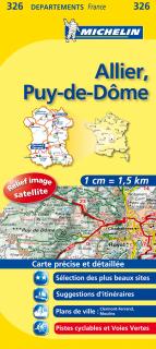
The MICHELIN Allier, Puy-de-DĂ´me local map, scale 1/150,000 is the ideal companion to fully explore this French area and provides star-rated Michelin tourist itineraries and attractions, as well as impressive 3D relief mapping. MICHELIN local maps are perfect for cyclists and outdoor enthusiasts with over 20 leisure symbols, extensive coverage of cycling paths and nature trails. With MICHELIN local maps, find more than just your way!
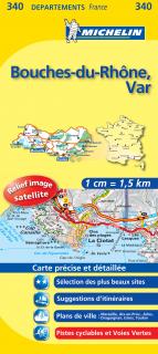
The MICHELIN Bouches-du-RhĂ´ne, Var local map, scale 1 /150,000 is the ideal companion to fully explore southern France and provides star-rated Michelin tourist itineraries and attractions, as well as impressive 3D relief mapping. MICHELIN local maps are perfect for cyclists and outdoor enthusiasts with over 20 leisure symbols, extensive coverage of cycling paths and nature trails. With MICHELIN local maps, find more than just your way!
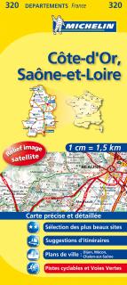
The MICHELIN CĂ´te-d'Or, SaĂ´ne-et-Loire local map, scale 1/150,000 is the ideal companion to fully explore these French local areas and provides star-rated Michelin tourist itineraries and attractions, as well as impressive 3D relief mapping. MICHELIN local maps are perfect for cyclists and outdoor enthusiasts with over 20 leisure symbols, extensive coverage of cycling paths and nature trails. With MICHELIN local maps, find more than just your way!
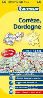
The MICHELIN Corrèze, Dordogne local map, scale 1/150,000 is the ideal companion to fully explore these popular French areas and provides star-rated Michelin tourist itineraries and attractions, as well as impressive 3D relief mapping. MICHELIN local maps are perfect for cyclists and outdoor enthusiasts with over 20 leisure symbols, extensive coverage of cycling paths and nature trails. With MICHELIN local maps, find more than just your way!
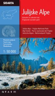
Julijske Alpe Eastern & Western part, Triglav national park 1:50.000 One of the few maps that covers the entire territory of the Julian Alps, from the westernmost Jôf Fuart on the Italian side to the Lake Bled in the east. Beside the waymarked paths, unmarked trails and ski tours the map includes also: sports climbing areas, natural and cultural points of interest and paragliding take-off sites. GPS, WGS84.
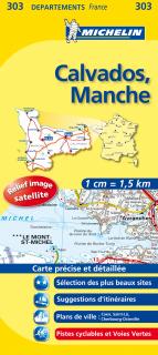
The MICHELIN Calvados, Manche local map, scale 1/150,000 is the ideal companion to fully explore the coastal part of Normandy and provides star-rated Michelin tourist itineraries and attractions, as well as impressive 3D relief mapping. MICHELIN local maps are perfect for cyclists and outdoor enthusiasts with over 20 leisure symbols, extensive coverage of cycling paths and nature trails. With MICHELIN local maps, find more than just your way!
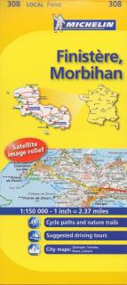
The MICHELIN Finistére, Morbihan local map, scale 1/150,000 is the ideal companion to fully explore Southern Brittany and provides star-rated Michelin tourist itineraries and attractions, as well as impressive 3D relief mapping. MICHELIN local maps are perfect for cyclists and outdoor enthusiasts with over 20 leisure symbols, extensive coverage of cycling paths and nature trails. With MICHELIN local maps, find more than just your way!
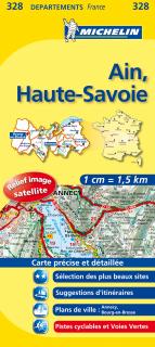
The MICHELIN Ain, Haute-Savoie local map, scale 1/150,000 is the ideal companion to fully explore this French area and provides star-rated Michelin tourist itineraries and attractions, as well as impressive 3D relief mapping. MICHELIN local maps are perfect for cyclists and outdoor enthusiasts with over 20 leisure symbols, extensive coverage of cycling paths and nature trails. With MICHELIN local maps, find more than just your way!
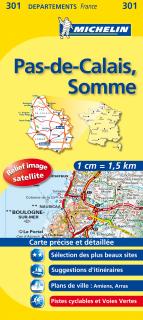
The MICHELIN Pas-de-Calais, Somme local map, scale 1/150,000 is the ideal companion to fully explore this northern part of France and provides star-rated Michelin tourist itineraries and attractions, as well as impressive 3D relief mapping. MICHELIN local maps are perfect for cyclist and outdoor enthusiasts with over 20 leisure symbols, extensive coverage of cycling paths and nature trails. With MICHELIN local maps, find more than just your way!